



Turning landscapes into data: LiDAR captures terrain, vegetation and infrastructure as detailed 3D point clouds. At AeroVision Canada, powerful computing helps transform these datasets into practical insights for infrastructure inspection, mapping and project planning. AI-generated illustration.
Capturing millions of LiDAR measurements from the air is only the beginning. For AeroVision Canada, the real challenge comes afterward: transforming enormous volumes of geospatial data into accurate 3D models, detailed terrain maps and actionable information for customers.
That process can involve terabytes of data and hours of computational work. As datasets grow, processing performance becomes increasingly important to project delivery.
AeroVision specializes in LiDAR, surveying and aerial inspections, helping organizations capture and analyze detailed information about infrastructure, terrain and physical assets. Its work spans construction, engineering, energy, utilities and infrastructure, with capabilities including aerial and terrestrial LiDAR, photogrammetry, 3D modelling and specialized inspections.

Remote inspection in action: A pilot maintains visual contact as the drone surveys a transmission tower from a safe distance. Image courtesy of AeroVision Canada.
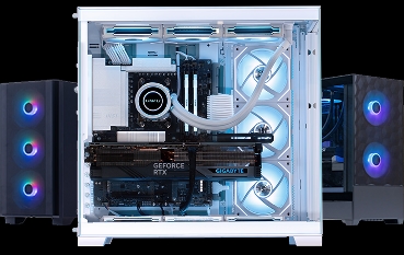
To keep pace with increasingly demanding datasets, AeroVision partnered with Quoted Tech to develop a high-performance workstation engineered for large-scale point-cloud processing, photogrammetry and 3D visualization.
The Challenge: When Data Collection Outpaces Processing
Modern LiDAR systems can capture millions of individual measurements, creating highly detailed point clouds that represent physical environments in three dimensions.
For AeroVision, those datasets can grow to multiple terabytes, particularly when projects involve extensive geographic areas, complex infrastructure or high-resolution surveys.
Transforming that raw information into useful deliverables involves several computationally demanding steps.
Point-cloud registration aligns multiple scans into a common coordinate system. Filtering and classification help distinguish terrain, vegetation, structures and other features. Additional processing generates surface models, detailed 3D representations and visualization products.
Photogrammetry introduces further demands, using overlapping images to reconstruct three-dimensional environments.
These workflows place different requirements on computing hardware.
Some operations benefit from high CPU core counts and parallel processing. Others require substantial system memory to accommodate large working datasets. Depending on the software, GPU acceleration becomes important for supported data processing and interactive 3D visualization.
When any one of these resources becomes a bottleneck, the entire workflow can slow down.
For AeroVision, some processing and point-cloud registration jobs previously required overnight runs.
That delay affected more than computing time. It influenced how quickly the team could review results, make adjustments and prepare deliverables for customers.
As projects became larger and more complex, AeroVision needed computing infrastructure capable of processing substantial datasets without introducing unnecessary delays.
The objective wasn't simply to build a faster computer. It was to reduce the time between capturing data and delivering useful information.
The Solution: A Workstation Engineered for Geospatial Computing
Rather than recommending a conventional workstation configuration, Quoted Tech approached AeroVision's requirements by considering the demands of its complete geospatial workflow.
The resulting system combines substantial CPU processing capacity, exceptionally large system memory and high-performance GPU acceleration.
At its centre is an AMD Ryzen Threadripper PRO 9975WX, a 32-core processor designed for demanding professional workloads.
For AeroVision, the processor provides significant computational capacity for CPU-intensive operations, particularly applications capable of distributing work across multiple cores.
Equally important is the workstation's 512GB of DDR5 ECC memory.
Large point-cloud datasets and complex 3D environments can consume enormous amounts of RAM. When working datasets exceed available memory, applications may need to rely more heavily on storage, potentially slowing processing considerably.
Providing substantial memory capacity helps AeroVision accommodate larger datasets while reducing memory-related constraints.
ECC memory adds another layer of reliability by detecting and correcting certain memory errors, an important consideration for computational workloads that may run for extended periods.
The workstation also incorporates an NVIDIA GeForce RTX 5090, providing GPU acceleration for compatible photogrammetry applications, 3D visualization and other graphics-intensive processing tasks.
Each component addresses a different requirement of AeroVision's workflow.
The Threadripper PRO processor provides parallel processing capacity, 512GB of ECC memory supports exceptionally large working datasets, and the RTX 5090 delivers acceleration for compatible applications and visualization. Together, they create a computing platform designed around the complete geospatial workflow rather than optimizing for a single performance metric.
For Quoted Tech, that balance was central to the design.
A workstation with an exceptionally powerful GPU may still struggle if it lacks sufficient memory for massive point clouds. Similarly, high CPU core counts offer limited value when another component becomes the bottleneck.
By considering how AeroVision's applications use processing power, memory and graphics resources, Quoted Tech developed a system intended to address the computational demands of its daily operations.
The Results: Less Waiting, More Processing
For AeroVision, the most important improvement is the time required to transform captured data into usable results.
Processing and point-cloud registration workloads that previously required overnight runs can now be completed substantially faster.
That improvement changes how the team manages projects.
Instead of waiting until the following day to review a processing result, technical staff can move more quickly through data preparation, quality checks, adjustments and subsequent processing stages.
The additional computing capacity also helps AeroVision work with increasingly large and complex point-cloud datasets.
For a business delivering detailed surveys, models and other geospatial products, these improvements extend beyond the workstation itself.

Drone-mounted LiDAR maps terrain, vegetation and infrastructure in 3D, helping utilities measure clearances throughout the corridor with precision. Image courtesy of AeroVision Canada.
Faster processing can shorten the interval between data capture and delivery, improve responsiveness to project requirements and give technical staff more time to focus on analysis rather than waiting for computations to finish.
It also provides greater flexibility when projects require adjustments.
A processing result may reveal that additional filtering, registration or classification is needed. Reducing the time required for those operations allows the team to revisit and refine its work more efficiently.
The workstation's substantial memory capacity and processing resources also provide additional headroom as AeroVision takes on projects involving larger datasets and more demanding computational requirements.
The value is not simply completing an individual task faster. It is reducing computational delays throughout a workflow where multiple processing stages contribute to the finished deliverable.
Beyond the Point Cloud: Turning Data into Decisions
AeroVision's work begins with capturing highly detailed information about the physical world. But the value of that information is realized when it becomes something customers can use: accurate terrain models, infrastructure assessments, detailed surveys and three-dimensional representations of complex environments.
As LiDAR and photogrammetry technologies continue to advance, the volume of information they generate will only increase.
Processing that data efficiently is becoming just as important as capturing it.
For AeroVision, the new workstation provides the computing capacity to handle increasingly demanding projects while reducing the time spent waiting for results.
The project also illustrates why specialized workstation design begins with understanding the application.
High CPU core counts, substantial system memory and GPU acceleration each contribute differently to geospatial processing. The right balance depends on the datasets, software and workflows involved.
By engineering a system around those requirements, Quoted Tech helped AeroVision address computational bottlenecks and keep projects moving.
The right workstation doesn't just process more data. It helps turn that data into results, faster.